Color country: Best drives to see fall leaves in Northern Utah
-
-

FRANK BOTT/Daily Herald
Fall leaves along the Vivian Creek Trail on the way into the Uinta National Forest from the entrance of Provo Canyon's Vivian Creek Park Monday afternoon.
Fall leaves along the Vivian Creek Trail on the way into the Uinta National Forest from the entrance of Provo Canyon’s Vivian Creek Park Monday afternoon.
-

-
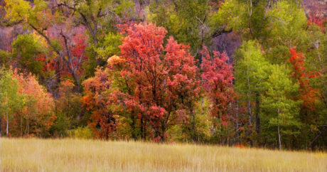
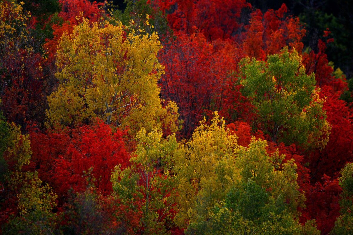
Carotenoid pigments remain in leaves as brilliant colors after a tree’s food making process, carried out by the green colored chlorophyll, ends. These pigments or colors trumpet the end of Summer and the beginning of Fall, as seen off trail 041 above Tibble Fork Reservoir in the Uintas National Forest Wednesday, September 21, 2005.
-
-
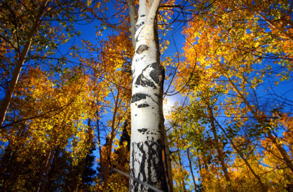
Aspen trees in Payson Canyon show off thier fall colors as thier leaves turn from green to bright yellow in 2003.
Northern Utah has many stunning views of changing fall leaves as the foliage (and sometimes wildflowers) transition to fall and prepare for the winter.
Catching them all may be difficult, but here are a few places you can adventure to take in autumn vistas around the area.
BRIAN WAGNER/Daily Herald
Carotenoid pigments remain in leaves as brilliant colors after a tree's food making process, carried out by the green colored chlorophyll, ends. These pigments or colors trumpet the end of Summer and the beginning of Fall, as seen off trail 041 above Tibble Fork Reservoir in the Uintas National Forest Wednesday, September 21, 2005.
Typically, fall colors pick up steam in mid-September and peak in late September to early October. Mileage on just how stunning each year can be varies due to weather and timing. KSL.com reports fall colors began appearing earlier than normal in 2025 due to cool overnight temperatures.
Practice caution in some areas as several drives include elevation climbs or descents on winding mountain roads near dropoffs — though this list centers on paved highways that most cars can traverse (in other words, the focus here is not on ATV trails or dirt/gravel passes that might require high clearance or provide white-knuckle narrows, such as Farmington Canyon).
Many of these drives can have as many outdoor components as you’d like, with nature areas, parks or hiking and biking trails accessible nearby. Your own research can reveal which of those options might be appropriate for you or your family.
LOGAN/BRIGHAM CITY
LOGAN CANYON: U.S. Highway 89’s Cache County stretch is typically a remarkable one, featuring red and orange maples, yellow quaking aspens and evergreens as you wind from Logan as far as you want toward Bear Lake. The highway crosses back and forth over the Logan River. The road has earned a “scenic byway” designation. Distance: 37 miles one way if you go the distance from 1500 North in Logan all the way to Garden City/Bear Lake.
SARDINE CANYON: Using Highway 89 could make Sardine Canyon an appetizer on the way to Logan Canyon, or its own fall drive by itself. The trip (starting where Perry meets Brigham City) takes you north past Mantua Reservoir, another climb up and then down to Dry Lake, and continuing to Logan with pockets of colors in the hillsides surrounding most of the journey. Distance: 22 miles one way, from the mouth of the canyon in Brigham City to 1000 West at the southeastern tip of Logan.
OGDEN/WEBER COUNTY

Ian Wingfield/the Daily Herald
Aspen trees in Payson Canyon show off thier fall colors as thier leaves turn from green to bright yellow in 2003.
OGDEN CANYON AND VALLEY: Exiting Ogden going east on 12th Street takes you into the tight-winding Ogden Canyon and its cliffside colors. State Highway 39 takes you to Pineview Reservoir, where views open up to the surrounding hillsides. Remaining on Highway 39 takes you to Huntsville, where you continue north to loop around the reservoir, going west to the Valley Market in Eden and then south back toward the reservoir dam and a right turn back toward Ogden. Distance: 28 miles round trip beginning at the intersection of 12th Street and Harrison Boulevard in Ogden.
NORTH OGDEN DIVIDE: Called “The Divide,” North Ogden Canyon Road is a narrow (though improved) two-lane road that connects North Ogden to the Ogden Valley via a mountain pass. It can be accessed by going east on 3100 North in North Ogden, but can also be an alternate ending to the above Ogden Canyon trip. Instead of turning south in Eden, continue northwest on State Highway 162 to 4100 North in Liberty. Going west, that road becomes North Ogden Canyon Road and the climb begins over the pass into North Ogden.
TRAPPER’S LOOP: Trapper’s Loop Road is a mountain pass that connects Ogden and Weber Canyons, officially numbered State Highway 167, and is as enjoyable in either direction. Using the above Ogden Canyon trip, Highway 39 reaches Trapper’s Loop after traveling the southern shore of Pineview Reservoir. Going south on Trapper’s Loop, the climb peaks near Snowbasin Resort and descends to Mountain Green and Interstate 84. Distance: approximately 27 miles either direction, beginning at either the mouth of Weber Canyon on Interstate 84, or at 12th Street and Harrison Boulevard entering Ogden Canyon.
DAVIS COUNTY
MUELLER PARK ROAD: This short jaunt out of Bountiful provides an elevated look over the valley and into the nearby canyon. Further exploration provides hikes, but otherwise the typical drive is going southeast out of town on Mueller Park Road to the Mueller Park Picnic Area, and back. Distance: 2.4 miles round trip, starting at Mueller Park Road and Bonneville Shoreline Trail in southeast Bountiful.
MORGAN COUNTY
EAST CANYON: The drive from Morgan to East Canyon Reservoir is a unique blend of canyon driving with views of farms/ranches in spots, and subtle red-rock outcroppings in others until you reach the reservoir and its vistas. Distance: Starting on Morgan’s main street (State Highway 66) after exiting Interstate 84, it’s 12 miles one way going south to East Canyon State Park on the north end of the reservoir. Like many drives on this list, reversing course and retracing the route can provide a new look at the same drive. Or, continuing to East Canyon Road/Highway 65 going northeast away from the reservoir takes you to Henefer, where you can pick up Interstate 84 going west, go past Devil’s Slide and complete the loop back to Morgan (that loop is about 35 miles). Alternate: Connect to Emigration Canyon (see below).
SALT LAKE CITY/COUNTY
EMIGRATION CANYON: The eastward, peaceful trip out of Salt Lake City starts near Hogle Zoo and slowly takes you past tree-packed canyon residences and to Little Mountain Summit until you reach a few descending switchbacks to Little Dell Reservoir. Some pull-offs are available along the way to take in the view. Distance: From Hogle Zoo to the reservoir, one way, is 9 miles. If you don’t turn around, you can catch Highway 65 south to Interstate 80 and west back into the Salt Lake Valley via Parley’s Canyon, or east going toward Park City.
Alternate: For a long adventure with a worth-it payoff, continue from Little Dell Reservoir north on Highway 65 instead, climbing to Big Mountain Summit (some switchbacks) for breathtaking views of deciduous trees. The descent takes you toward Morgan County and a sudden switch to mountain evergreens mixed with quaking aspens, connecting you to East Canyon Reservoir from the south. At the north end of the reservoir, head west on Highway 66 toward Morgan. Distance: This drive from Hogle Zoo to Morgan is 39 miles.
BIG COTTONWOOD CANYON: This beautiful drive begins east of Cottonwood Heights, just off the southeast corner of the Interstate 215 loop. Big Cottonwood Canyon Road/Highway 190 takes you east out of town, climbing until you reach Brighton Resort. Distance: 16 miles one way, so 32 if you turn around and descend back toward the Salt Lake Valley. Alternate: See Guardsman Pass below.
GUARDSMAN PASS SCENIC BACKWAY: Instead of returning through Big Cottonwood Canyon, Guardsman Pass Road begins near Brighton Resort and keeps you at high elevation to continue the sights. Going 5 miles (and a couple switchbacks) east takes you to a fork. One road continues east and eventually north on State Highway 224 toward Deer Valley and into Park City (another 6 miles). Or, going south, Pine Canyon Road takes you to Midway/Wasatch Mountain State Park in the beautiful Heber Valley (another 8 miles).
MILLCREEK CANYON: going east out of Millcreek, this local favorite is out of commission for two falls, closed from May 2025 to Fall 2026 for construction to improve safety, widen the road in some places and add parking lots near trails. (Note: this drive, when open, requires a $5 fee.)
PROVO/UTAH COUNTY
PROVO CANYON: It’s an embarrassment of riches in Utah, and Provo Canyon adds an entry as good as the rest. The canyon is accessed from 800 North in Orem if you’re coming from the north, or from University Ave/U.S. 189, or also on Canyon Road, in Provo. Highway 189 is a scenic byway that follows the Provo River past Mount Timpanogos Park and northeast out of town into canyon driving, with views of towering cliffs and several waterfalls (if water still flows). New beauty is discovered upon reaching Deer Creek Reservoir, giving options to visit Midway (going north) or Heber City (continuing on 189). Distance: 18 miles one way from the mouth of the canyon in Orem to Charleston township as you arrive in Heber Valley.
ALPINE LOOP: Possibly the most popular fall drive in the state, what’s called the “Alpine Loop” connects American Fork Canyon to Provo Canyon. American Fork Canyon begins at 11000 North and Canyon Road in Highland/Alpine/Cedar Hills and goes east along the American Fork River. It’s 3 miles on State Highway 92 to the parking lot for Timpanogos Cave National Monument. Continuing the drive on 92 begins the Alpine Loop Scenic Byway, which winds southeast toward Provo Canyon. Distance: About 27 miles, starting at the mouth of American Fork Canyon, completing the Alpine Loop and going west to the mouth of Provo Canyon. (Note: According to the U.S. Forest Service, there is no fee for travel along this route or to stop on gravel pull-offs not associated with developed recreation areas. But a recreation pass, $10 for 3 days, is required to stop at developed sites such as campgrounds and picnic areas.)
PAYSON CANYON/NEBO LOOP: Ready for a long adventure to central Utah? Mount Nebo Scenic Byway connects Payson to Nephi on a mountain drive featuring some steep climbs and well-known views of bright fall foliage. Going south on 600 East in Payson soon has you climbing the scenic byway to elevations above 9,000 feet. About half the way, an overlook provides a view of Mount Nebo. Not long after, you can access Devil’s Kitchen; the U.S. Forest Service says a short walk on a paved trail leads to a small platform to view red-rock formations akin to a “miniature Bryce Canyon.” Continue south on the loop until reaching State Highway 132, which takes you west to Nephi. Distance: This mountain pass from Payson to Nephi is about 40 miles one way.
-