ATV Adventures: Riding by the Tutsagubet Mining District on the Curly Hollow Trail
-

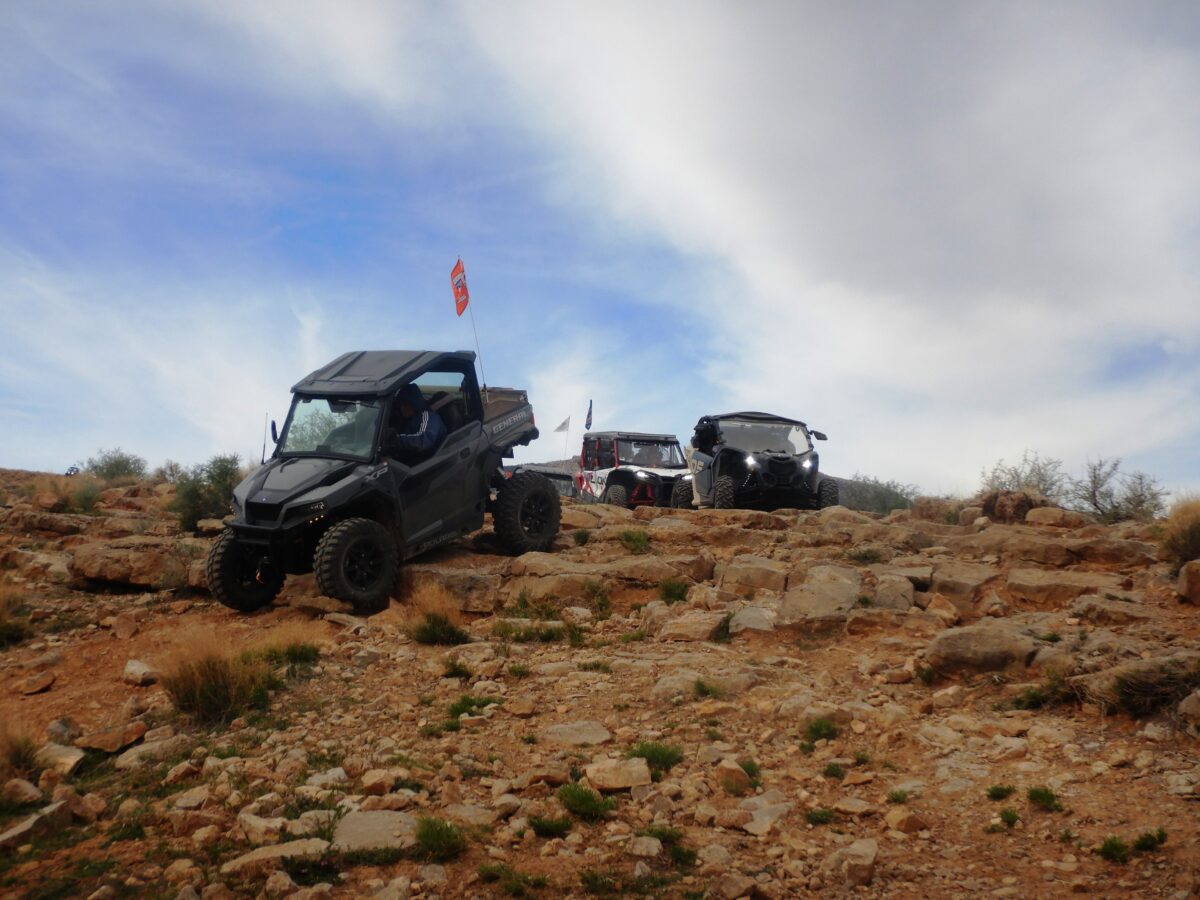
- Riders line up to drop over a ledge on the Curly Hollow Loop in the Mojave Desert.
-
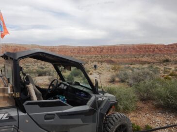
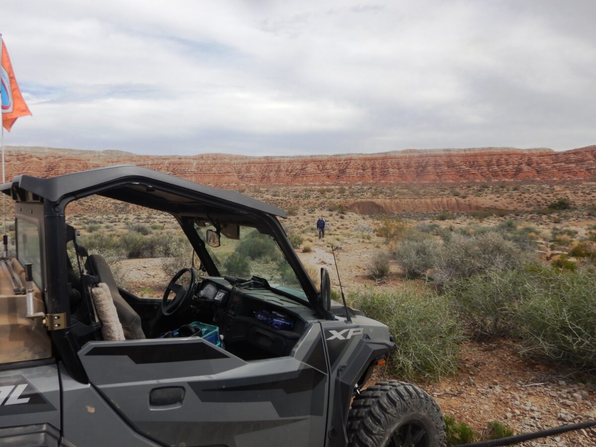
- We followed this red rock ridge for miles on the Curly Hollow Loop in the Mojave Desert.
It was the last day of February, and we were on the second day of a two-day ride out of Mesquite, Nevada. After a briefing in the parking lot of our Mesquite hotel, we pulled out of town hauling 22 UTVs on the way back to Utah. We had ourselves a convoy.
We turned off I-15 at the Beaver Dam exit onto Old Highway 91 and made our way north through town. There used to be an old gas station there, the Beaver Dam Station. There were signs all around the station that were appropriate to the town’s name. You put gas in your car at the “dam pumps”, the sign over the entrance to the store read, “the dam store,” they also had “dam restrooms.” There is a new Maverik station at the freeway exit — it isn’t so dam cute as the old one.
We continued north out of town to the geologic feature known as the Castle Cliff on the east side of the road. There was plenty of room to park our rigs and unload our machines. The temperature was in the low 60s, and the sky was partly cloudy – it was perfect for a ride.
I had downloaded a track for the Curly Hollow Trail onto my Ride Command GPS program. As we were lining up to begin the ride, I took a look at it. Imagine my surprise when I realized the trail wasn’t where I thought it was. I decided not to say anything and act like it was the plan all along.
I could see a trail on Ride Command that would connect us to the loop. I signaled the start of the ride and stopped just off the highway, headed south. After lining up and getting a count, we head back down the highway, turning southeast onto the Woodbury Study Area Road.
This took us into Joshua tree country. These desert plants are interesting in and of themselves, but at this time of year, they are just beginning to bloom. The blossoms are creamy white to greenish white, bell-shaped, and grow in heavy, tight clusters at the ends of branches, and they are a treat to see.
Joshua trees are best viewed in the Mojave Desert. They do not bloom every year – their synchronized, dramatic flowering depends on specific winter rain and temperature conditions. The yucca moth is the only insect that can pollinate the trees, acting as a crucial, specialized partner for reproduction.
In Bulldog Canyon, we stopped at an information kiosk and learned that we were on the southern side of the Tutsagubet Mining District. The name piqued my interest, but I couldn’t find a meaning for the word beyond the fact that it is derived from the Paiute language and refers to the local geography. The district was organized in the 1880s and produced a lot of silver and copper.
We continued through the canyon over Bulldog Pass. Just before the road that goes up to the Apex Mine, we joined the Curley Hollow Loop. I could see on the map several other mines that made up the Tutsagubet District.
I made a wrong turn at the top of the loop and had to turn around. As I made my way back down the line, signaling people to turn around, I met excited people wanting to know if we were lost yet. We turned northeast on a trail that was a little more primitive.
Coming to a ledge, we had to drop off. My wife didn’t feel safe, so she got out and walked down the hill. I dropped off the ledge without incident and watched the other machines negotiate the shelf without difficulty. This trail continued as we followed a beautiful red rock ridge down into Cottonwood Wash.
The cloud cover increased, providing some nice shade for lunch. We stopped at a place with many Joshua trees and broke out the camp chairs. We had a machine back down the trail with engine problems, so our grandson, Mark, went back to take a look.
Mark fixed the problem, we finished lunch, and got back on the trail. We completed the Curly Hollow Loop, went back over Bulldog Pass, down the canyon, and back to Castle Cliff, where we had started. It was a great ride of about 54 miles. When you go, take plenty of water, and keep the rubber side down. Enjoy this historic ride in early spring or late fall – the summer is too hot.
Lynn R. Blamires can be reached at quadmanone@gmail.com.