ATV Adventures: Discovering the history in the mountains of Delle in a UTV


-

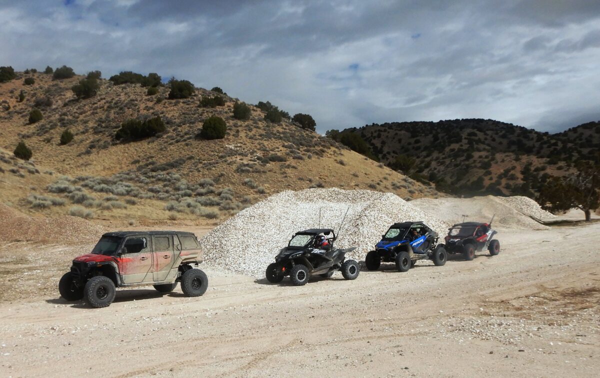
- Stopping for a break after coming off the Hastings Cutoff Road near Delle.
-

- Going under I-80 on our return to Delle after our trip around Cedar Mountain.
-
- The Navigation Arrow we found west of Delle.
-
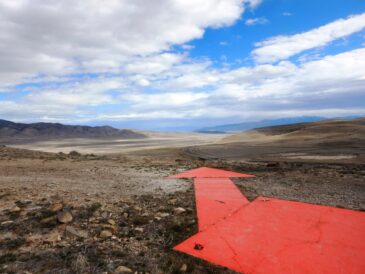
- The course change indicated by the arrow.
Finding new places to ride has been my quest since I rode my first ATV 34 years ago. One of the best sources for new trails is friends who have ridden places you haven’t. My friend, Dean Eborn of Layton, called to invite me on a ride to be staged in Delle, Utah. I was interested in good places to ride from Delle.
Delle was established in 1880 as a railroad village on the Western Pacific line. It was used as a water depot for steam engines in preparation for the trek across the famous salt flats. Originally named Dalles Spring for its source of water, about 12 miles away. The name was later shortened to Delle for telegraphic efficiency. The only sign of life now is a gas station with a good convenience store.
The rides I have taken out of Delle have been “ho-hum” at best, which has left me with mixed feelings. Dean assured me that this ride would not be ho-hum, so I lined up with five other machines on the west side of the gas station. I didn’t know it then, but we were headed for a grand adventure.
We left the staging area and headed southwest toward Cedar Mountain. Turning into the mountains, we rode through a narrow canyon separating a northside knoll from the range of mountains running south. It was a fun twisty trail that took us to the other side of the mountain, where we joined a section of the famous pioneer trail known as the Hastings Cutoff.
We turned and followed a fast-track south, which took us between the mountain on our left and the Wendover Air Force Range on our right, where B-29 Superfortresses practiced bombing runs during World War II. Partway down the west side of the mountain, we picked up the Cedar Mountain Road, which took us into Rydalch Canyon and to Rydalch Pass, where we stopped for lunch. It was not a long stop – the wind was cold in the pass.
The canyon trail was another fun, narrow stretch with a twisting trail that took us back to the other side of the mountain, into Skull Valley. This side of the mountain had a sharp contrast with the side that had the military range. We came across a surprising number of cattle that seemed to find plenty to eat. The mothers were showing off their young calves, who were romping happily in the spring weather.
This road had some surprise turns that challenged our ability to keep the rubber side down. Everyone came through all right, but there were a few wakeup calls. We became more alert as we negotiated this trail.
As we made our way back to the north, we noticed interesting rock formations on the mountain. They were remarkable enough, in our opinion, (did I mention that my wife was with me on this trip?) to have a name. I know now that Cedar Mountain was the name, but that didn’t do justice to the knife-like blades of rock that pierced through the top of the mountain.
Soon, we joined the Hastings Cutoff Road. The Hastings Cutoff was an alternative route for westward-bound emigrants to California, as proposed by Lansford Hastings in The Emigrant’s Guide to Oregon and California. The ill-fated Donner Party took the route in 1846. Hastings himself did not travel the cutoff before writing the guide.
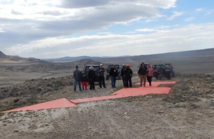
The road took us back over the mountain and across I-80 at the Lake Side Exit. On the other side of the Interstate, we climbed 200 feet to the top of a knoll. There, we found a concrete navigational arrow used in the 1930s by old air mail biplanes.
There are 11 of these arrows that still exist, located throughout Utah. The airmail route was marked by rotating red beacon lights mounted on 51-foot towers, visible at night. The towers were set on concrete arrows, 50 to 70 feet long and 11 feet wide, painted school-bus yellow, and pointing to the next beacon, roughly 10 miles away. They were designed to be visible from the air at an altitude of 3,000 feet. This one was painted orange.
Leaving the arrow, we dropped down off the top, crossed I-80, and turned back east to Delle. We finished a 90-mile ride through history in under five hours. What a fun ride. When you go, take plenty of water, keep the rubber side down, and enjoy visiting the historic places of Delle.
Lynn R. Blamires can be reached at quadmanone@gmail.com.