As lawmakers fight over dueling redistricting experts, Utahns ask: Why not one of our maps?
Legislative Redistricting Committee did not pick a favorite replacement congressional map, but will continue to take input until Oct. 6 vote
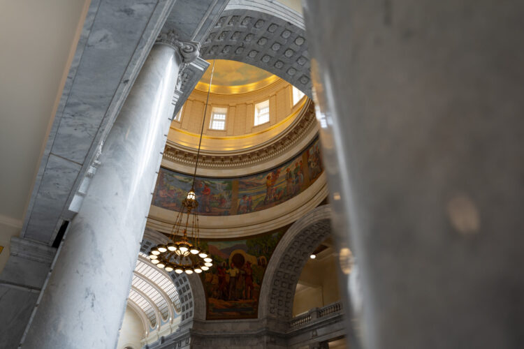
Photo by Spenser Heaps for Utah News Dispatch
The rotunda inside the Capitol in Salt Lake City is pictured on Thursday, Feb. 6, 2025.The second day of Utah’s court-ordered redistricting process saw plenty of fireworks on Wednesday, with Democrats and their dueling redistricting expert clashing with Republicans.
The Utah Legislature’s newly convened Legislative Redistricting Committee’s heated exchanges reached a crescendo when the committee’s only two Democrats — Senate Minority Leader Luz Escamilla, D-Salt Lake City, and Rep. Doug Owens, D-Millcreek — brought their hired expert, Daniel Magleby, a professor at SUNY Binghamton in New York, to present their preferred congressional map.
During their presentation, Magleby and Owens questioned whether Republicans’ retained redistricting expert — Sean Trende, a senior elections analyst for RealClearPolitics who drew a set of five maps that were presented to the committee on Monday — used a method that incorporated partisan data on the front end of his process, which Democrats and Magleby alleged would be a violation of Proposition 4, the voter-approved law that established a framework for an independent redistricting process.
Magleby said if he were to “pull maps out of a simulated set where I’ve already screened out those that are not symmetrical, (that) would be illegal, as I understand it, under Prop 4. You’re not allowed to do that.”
Magleby said maps must first be drawn following Proposition 4’s criteria, and only after should they be analyzed for any “undue advantage or disadvantage on a particular group.” He questioned whether, by “culling” out maps that were tested for partisan symmetry, Trende’s map-drawing process would abide by Proposition 4.
“If I’m only going to look at maps that are symmetrical to begin with, then I’ve already violated Proposition 4, and anything that comes from that is going to be illegal,” Magleby said.
Owens added that “what he just described as being illegal, we strongly suspect has happened.”
“We suspect there was a dataset incorporated into the test that Dr. Trende applied,” Owens said, though he also noted that Democrats’ requests to obtain Trende’s full data sets weren’t answered by Wednesday morning to help them verify that suspicion. “It’s as if we’re told to buy a car and we can’t lift the hood and look.”
The committee’s co-chairs, Rep. Candice Pierucci, R-Herriman, and Sen. Scott Sandall, then interjected with protests, with Pierucci saying, “That’s a pretty big allegation” and Sandall calling a point of order.
“You just demeaned us,” Sandall said, audibly angry. “I will not have that. You called us somehow hiding, lying, about everything that we’ve presented. … Our maps, these maps, were not developed with any political data. You just misrepresented that, and that’s out of order.”
Wednesday’s committee marked the second time this week that the Legislative Redistricting Committee has met as lawmakers try to narrow down which map the full Utah Legislature will ultimately vote on during a special session on Oct. 6 to be submitted to a judge.
That judge — 3rd District Court Judge Dianna Gibson — will ultimately decide which map will replace the 2021 congressional boundaries she voided in a ruling last month, which deemed that map a result of an unconstitutional process after lawmakers repealed and replaced Proposition 4 with a law that turned the independent redistricting commission into an advisory body lawmakers could ultimately ignore.
While Republican legislative leaders vehemently disagree with Gibson’s ruling and continue to fight it in court — with an appeal pending in the Utah Supreme Court and statements that they also intend to appeal to the U.S. Supreme Court if necessary — they have said in the meantime they’ll abide by Gibson’s order, which gave the Legislature until Oct. 6 to choose a preferred replacement congressional map.
The judge also gave the same Oct. 6 deadline to plaintiffs in the redistricting lawsuit to submit a map for consideration. She has a deadline of Nov. 10 to choose a new congressional map in time for the 2026 midterm elections.
The Legislative Redistricting Committee did not pick a preferred map on Wednesday. Instead, it left the door open for more map proposals — from both lawmakers and the public — to be submitted through the committee’s website, where the maps are made public. As of Wednesday afternoon, dozens of maps had been submitted to lawmakers since they began taking submissions for the 2025 map last week.
The judge gave lawmakers until Thursday for an eligible proposed map to be “published” before a 10-day public comment period leading up to the Oct. 6 vote. Sandall said in order for a map to be considered for the Oct. 6 special session and meet the court’s publication deadline, it must be submitted through the commission’s website no later than the end of the day Thursday.
“The Legislature cannot adopt a map that is not publicly available for comment starting tomorrow, Sept. 25,” Pierucci said. “So when we meet back in a special session, it will be one of these maps that were publicly available to meet the 10-day window that was outlined by Judge Gibson in her timeline and order.”
Sandall said lawmakers are “considering many options and we want to gather as much public comment as possible … so we’re soliciting feedback on multiple maps.”
“Public comment is meaningless if we make a decision today,” he said.
During Wednesday’s meeting, the legislative committee reviewed all five map options drawn by Republicans’ retained expert, Trende, as well as Democrats’ preferred map drawn by Magleby. They also took comments from more than two dozen Utahns, with many urging lawmakers to avoid gerrymandering and follow Proposition 4, while several also expressed distrust in the Legislature’s stated intentions to carry out a “fair” process.
Proposed maps
A significant chunk of Wednesday’s committee meeting focused on reviewing the five maps drawn by Republicans’ expert, Trende.
All of the maps would be relatively more competitive for Democrats when compared to the 2021 map that the court has since tossed out, though Republicans would still have an advantage in most of the districts. Under that 2021 map, Republicans have consistently dominated all four of Utah’s congressional seats.
Democrats have expressed concerns with all five of those maps, resistant to mixing urban and rural areas. Republican legislative leaders including Senate President Stuart Adams, R-Layton, and House Speaker Mike Schultz, R-Hooper, have said, however, that they want a map that creates four districts that all represent “both urban and rural voices.”
Utah’s current congressional map is a form of what’s been called the “slice of the pie” approach, dissecting Utah’s urban core and most populated area of Salt Lake County into four separate districts.
In contrast, what’s known as a “doughnut hole” approach would create a map that may, for example, carve out a district concentrated around the state’s capital of Salt Lake City, the state’s darkest blue Democratic stronghold.
Democrats’ preferred map, drawn by Magleby and named after Escamilla and Owens, carves out two doughnut-hole shapes, one around Salt Lake City and the northern part of Salt Lake County, and one around the southern part of Salt Lake County and northern Utah County.
During Wednesday’s committee discussion, several Republican lawmakers expressed preference for maps that split the least number of cities and counties as possible, and those that mix rural and urban voices while following natural barriers to transportation.
Rep. Walt Brooks, R-St. George, said he liked the maps titled options A and B, for those reasons. He said Lake Powell and the Colorado River are also major waterways that are vital for southern Utah, “and to be able to have two Congress individuals to represent that water source is critical to the entire state of Utah.”
According to Trende’s own analysis of his maps, all of his five comply with Proposition 4’s requirements which are the following criteria, in order of importance:
- Equal population
- Minimize city splits
- Minimize county splits
- Compactness
- Contiguity and ease of transportation
- Preserve traditional neighborhoods and communities of interest
- Follow natural and geographic boundaries
- Maximize boundary agreement
Map A splits three cities (North Salt Lake, Pleasant Grove and West Valley) and three counties (Davis, Salt Lake and Utah).
Map B splits three cities (North Salt Lake, Provo and West Jordan) and three counties (Davis, Salt Lake and Utah). Map C splits three cities (Millcreek, North Salt Lake and Pleasant Grove) and three counties (Davis, Salt Lake and Utah).
Map D splits three cities (Eagle Mountain, Layton and Taylorsville) and five counties (Davis, Salt Lake, Utah, Tooele and Wasatch).
Map E splits two cities (Cottonwood Heights and Provo) and four counties (Salt Lake, Summit, Utah and Wasatch).
Democrats’ proposed map, Magleby said, splits 13 cities and four counties (Davis, Morgan, Salt Lake and Utah). He said it was based off of a map drawn by the Independent Redistricting Commission back in 2021.
“When I’ve done my own analysis using the Harvard simulations, it falls well within the accepted range of what we would expect from a neutral redistricting process,” Magleby said.
Several Republicans on the committee, however, expressed concerns about the number of city splits Magleby’s map would impose and expressed reluctance to support the map, arguing others would better adhere to Proposition 4’s criteria.
Another map, however, not submitted by either of lawmakers’ dueling experts but by a Utahn, achieved even fewer city splits.
Why not pick a map submitted by Utahns?
Stuart Hepworth, a South Jordan resident, has submitted 14 maps for lawmakers to consider. One of his latest drafts would split zero cities and only three counties based on the Legislative Redistricting Committee’s map C.
“This map outperforms all previously submitted maps (from myself, the legislature, or other members of the public) in complying with Prop 4’s redistricting criteria in the statutory order of priority,” Hepworth wrote with his submission.
He told the committee that his map has the “bare minimum” county splits, splitting Salt Lake, Utah and “a tiny bit” of Weber county.
“I followed the committee’s process in drawing the map, not viewing partisan data during the map’s creation,” Hepworth told the committee. “I believe this map is categorically superior to all five of Dr. Trende’s maps and following Prop 4’s criteria.”
Sandall, however, noted that in the past Hepworth has drawn maps using Dave’s Redistricting online tool, which allows users to toggle views of partisan data. He pointed to a video Hepworth posted on YouTube earlier this month in which he demonstrated drawing a map in under six minutes. Hepworth acknowledged that map was drawn with a political data viewer turned on.
Another commenter, James Carter from Salt Lake City, urged lawmakers to choose a map drawn by members of the public — like from Hepworth — rather than one drawn by their chosen dueling experts. He said any statistics student “knows that there’s no such thing as an unbiased statistical analysis presentation.”
“Every presentation of statistical analyses will include the motivations, at least, of the presenter. And the motivations that I’ve heard from both the majority and minority caucus, from opposing experts, has been fairly along the lines of ‘how far can we stretch our legal mandate to get what we want and stick it to the other guys,'” Carter said.
In order to achieve a “fair, representative map” under Proposition 4, he urged the committee to “reject all six maps proposed today” and instead consider maps drawn by Hepworth or others “which have been drawn with fairness and with all of the requirements of Prop 4 in mind.”
Sandall, however, indicated he had reservations about doing that, saying it’s “impossible to ascertain amongst all the maps that were drawn and submitted if any of them were drawn using political data in the timeframe that we have.
“It’s almost an impossible task,” he said. “Because that is our mandate under Prop 4, no political consideration can be made in drawing a map. And we would have to go in and depose any or all of the map drawers to find out if political data was used, and we just don’t have that time.”
Local News

As lawmakers fight over dueling redistricting experts, Utahns ask: Why not one of our maps?
County Commission Chair Brandon Gordon receives state award for warming center efforts; Utah County rolls out year two winter homeless services plan