Provo proposing new floodplain maps; open house set Wednesday

Courtesy Division of Emergency Management
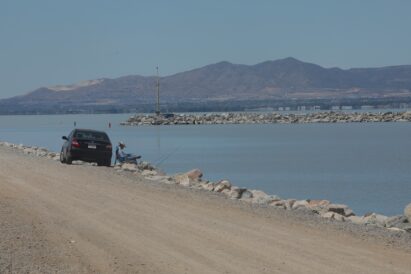
This image shows a new watershed map for Provo.Provo’s preparation for spring flooding helped stave off disaster. But that does not mean large rains or next winter’s runoff won’t affect those in Provo’s floodplains.
There is always a flood risk, and new housing and business development near those floodplains could one day be in danger, according to the Utah Division of Environmental Management.
Because of that ongoing risk, Utah County and the cities of Provo and Orem have been working with the DEM and Federal Emergency Management Agency to replace outdated local floodplain maps dating back to the 1980s.
DEM and Provo City community officials will conduct a public open house from 5-8 p.m. Wednesday at the Provo Recreation Center, 320 W. 500 North. Residents of Provo will have an opportunity to learn about the latest flood study, view the updated maps, identify if their property will be impacted by the changes and get information about any insurance or development standards that may impact their property. There also will be an opportunity to address questions to the team of experts from FEMA as well as state, city and county officials in attendance.
“Provo City has been communicating with residents to help inform them of FEMA’s updated flood risk maps and how it could impact them. The open house is a great opportunity for residents to learn about the results from FEMA and the Utah Division of Emergency Management’s study regarding areas around Utah Lake and the Provo River,” said Dave Decker, director of Provo’s Public Works department.
According to the DEM, this effort of new mapping involves the use of high-resolution topography data and state-of-the-art hydrologic and hydraulic data and modeling techniques to improve the accuracy of the resulting floodplain information.
In 2017, Provo City officials requested that a revision of the Utah Lake shoreline be added to the flood study. Other communities bordering Utah Lake agreed that an updated, unified study of the shoreline would be useful.
There have been substantial flood control improvements since the heavy 1983 flooding season, according to the DEM. Jordan River now has more capacity to draw water from Utah Lake. Construction on the Jordanelle Dam finished in 1992, and debris basins at the mouths of several canyons were either built or fortified. Deer Creek Dam also provides significant flood control protection, although flood control is not its designed or designated function.
In spite of these structures and improvements, new weather patterns present increasing risk for property owners near the levees, according to FEMA. Below the Deer Creek Dam, there are 128 square miles of Provo River watershed. Looking at worst-case scenarios, if an intense thunderstorm dropped heavy amounts of precipitation there, it is possible the Provo River could overflow its banks. And if a wildfire had destabilized soils and vegetation beforehand, flooding risk would rise even higher.
A surge in residential and business development west of Interstate 15 is another factor increasing flood risk. Some of this development has taken place on areas that were flooded in 1952 or 1983 and are likely to flood again, according to the DEM.
In the past few years, the Provo River and Utah Lake levees were determined to not be meeting structural or operational requirements for certification. In 2021, Provo City contracted CRS Engineers to study levees along the river and the lake to document the existing condition and present alternatives for rehabilitating them.
Since that time, much has been accomplished, with rehabilitation projects beginning near the Provo Airport. As each mitigation project is completed, the city can apply to amend the affected flood risk maps.
According to the DEM, however, information from one recent project doesn’t seem to have been properly shared in this effort.
“The Utah Reclamation Mitigation and Conservation Commission was included as a partner during discussions for the Provo River Levee Study and our study team is aware of the Utah Lake Delta Restoration Project,” said Jamie Huff, the DEM’s risk map program manager. “The Provo River Levee Study is intended to revise the 1% annual chance flood risk for Provo River and the maps are developed using the best available data at the time the study is conducted.”
“Unfortunately, the data for the Delta Restoration Project was in planning stages and not yet final, so our study team was not able to incorporate any final design into this Provo River Levee Flood Study,” Huff noted. “We are aware construction is now complete and, if necessary, there will be an opportunity for the impacted communities to update the maps at a later date. It is our understanding that the Delta Restoration Project was intended for ecosystem restoration and was not intended to revise the 1% annual chance flood risk. Flood risk from Provo River and Utah Lake for that area may still exist. We will continue to work with the impacted communities to identify the best path forward to incorporate the new changes to this area.”
FEMA uses its floodplain maps to establish insurance requirements and floodplain management standards through the National Flood Insurance Program.
Once published, these floodplain maps help communicate flood risk to current or potential property owners, motivating them to undertake mitigation measures to reduce potential losses and recover more rapidly when a flooding event occurs, according to the DEM.
At the community level, floodplain maps are important tools for professionals involved in emergency management, city engineering, transportation, public works, planning or building permits.