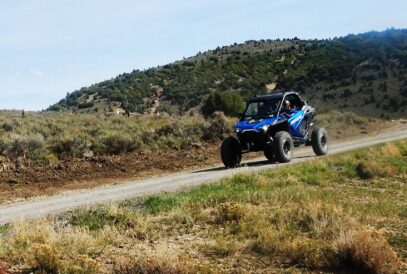
ATV Adventures: Riding ATV trails near Mount Elizabeth in Summit County
Courtesy Lynn R, Blamires
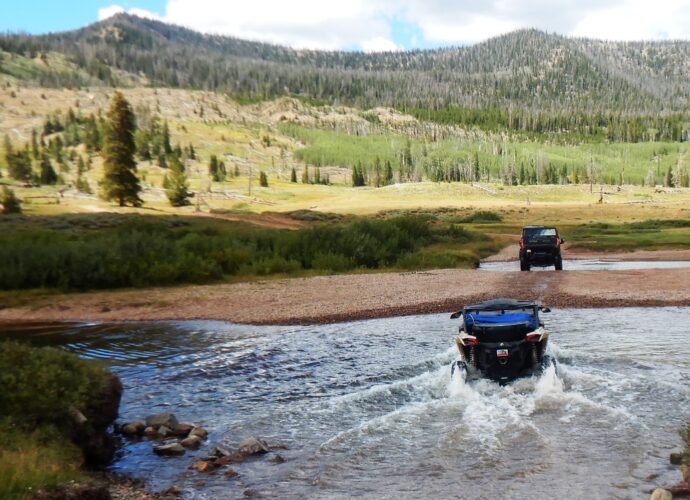
Crossing the West Fork of the Blacks Fork River.I love learning about trails I haven’t ridden. I got a call from a riding buddy, Terry Maxfield in Morgan, who has a friend who offered to take him on a favorite trail near the East Fork Campground in Summit County, and he invited me to come along. When my wife agreed to go with me, it was like all the planets had lined up. We had a ride scheduled, woo-hoo!
We met in Morgan, where we met Quinn and his wife, Sarah, who were leading the ride. Quinn was breaking in a new Can-Am HD11 he had just picked up. We pulled our trailers through Evanston, Wyoming, taking Highway 150 south out of town.
We staged at a parking lot on the east side of the highway just past Bear River Service. Leaving the staging area, we rode east on NF-58, which goes over Mount Elizabeth and drops down into the Meeker Cabins and China Meadows. We crossed Carter Creek and Christmas Tree Creek, then turned south and followed Mill Creek.
This trail took us to an old hunting cabin used by early settlers. It was situated across a creek at an altitude of 9,700 feet in a high valley. It was still standing, but it didn’t look like it would have been much shelter from a storm anymore.
The trail took us southeast, then north, to Lym Lake. This pretty little lake is longer than it is wide and sits at 10,120 feet. It is described as a large body of standing water. No water source feeds it. We found it a pretty place to take a break.
Leaving the lake, we traveled east, passing just below the top of Table Top Mountain. We turned north on the North Slope Road and stopped to take in a view of the valley. We were overlooking the West Fork of Blacks Fork as it snaked through the valley – what a peaceful scene that lay before us.
Looking due east, we could see the top of King’s Peak in the distance. Quin pointed out a trail that came off the top of the ridge and went straight down at a death-defying angle. He said he had been on it and that there is one little place that, if you could negotiate safely, then you wouldn’t die. He didn’t recommend it, whew!
We continued to follow the ridge until we rejoined NF-58, which brought us down into the valley we had viewed from the ridge. The trail took us along the west side of Fish Lake, then turned and took us down the east side as we went deeper into the valley. When we reached the bottom, we began to follow the meanderings of the Blacks Fork River.
The thought occurred to me as we passed Fish Lake: “Just how many Fish Lakes are there in Utah?” The internet had the answer – “There are at least 4 distinct lakes named Fish Lake spread across multiple counties in Utah.” Sevier County is home to the famous Fish Lake, the largest natural mountain lake in the state and a premier fishing destination in the Fishlake National Forest. Summit County features two separate lakes sharing the name Fish Lake, located high in the western Uinta Mountains within the Weber River drainage, and Uintah County contains another high-elevation alpine Fish Lake.
So that led to the question of how many Fish Lakes are there in the rest of the country? My research revealed too many to count. “There are dozens of lakes named ‘Fish Lake’ spread across various states in the United States, with individual states like Minnesota alone featuring over 25 water bodies by that exact name.” “Alaska features remote water bodies like Upper Fish Lake.” “Other states including Michigan, Wisconsin, Oregon, and Washington also have multiple local lakes and reservoirs bearing this name. So, if you are lost and manage to contact search and rescue and give your location as “Fish Lake,” you are truly lost.
Continuing our ride, we came to a point where we crossed the West Fork of Blacks Fork River and stopped in the trees at the edge of the valley for a break. A stream flowed down, with logs hollowed out to direct the water. We found that interesting and fun.
With plans to eat at a restaurant in Kamas, we turned back, finishing a ride of 51 miles. When you go, take plenty of water, keep the rubber side down, and enjoy exploring the Mount Elizabeth trails.
Note: The photos in the Living section on Aug. 22 were taken by Steve Webb and Paul Keoppel. We thank them for their contributions.
Lynn R. Blamires can be reached quadmanone@gmail.com.