ATV Adventures: Riding a UTV on the Chimney Rock Loop in the San Rafael Swell
-

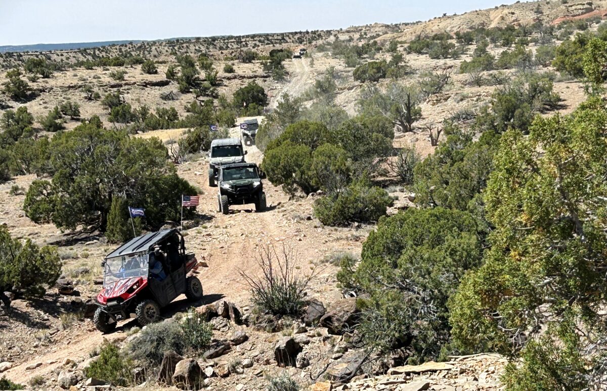
- Members of the NUATV Club follow the leader on the Chimney Rock Loop in the San Rafael Swell.
-

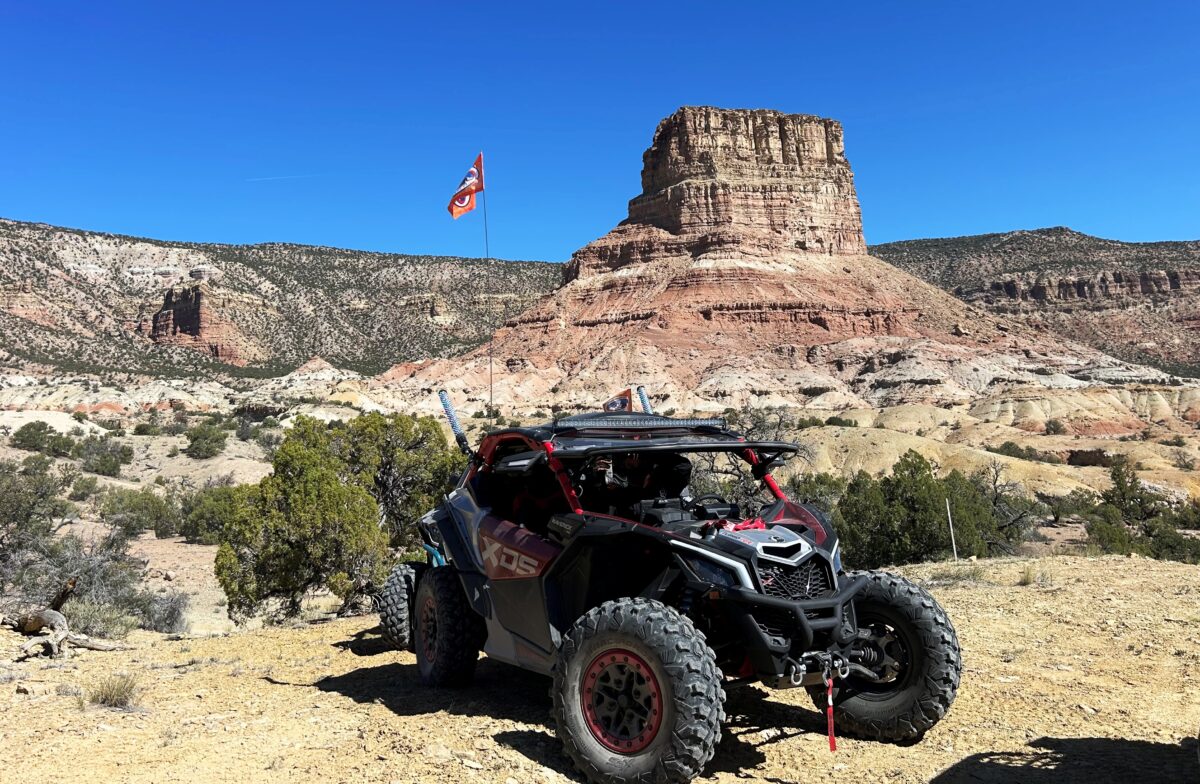
- Bry Davis of Layton sits in his Can-Am at Chimney Rock in the San Rafael Swell.
There is a road on the east side of Castle Dale that takes you into the San Rafael Swell. There is a sign on Highway 10 indicating access to the Swell, and a corral is near the corner as a landmark. That road will take you to a junction where there is a large area bordered by a buck-and-pole fence with vault toilets, picnic tables, and an information kiosk.
Roads at the junction go south to the Wedge Overlook, east to the Buckhorn Wash, or north to Huntington. We staged at the junction for our Chimney Rock Loop adventure. It was the second day of a three-day ride for the NUATV Club.
They were depending on me to lead 22 machines on this loop. I did a pre-ride on this trail 11 years ago. I had a GPS track from that ride, and I was depending on it still being a viable trail.
We left the staging area with perfect weather for a ride in the Swell. We used the drop system to allow riders to spread out on the trail to avoid eating dust. The leader drops a rider to indicate the direction to take at critical junctions.
The trail follows the base of the Cedar Mountains in a northeast direction. Chimney Rock is visible from the Chimney Rock Road, which comes out on Highway 191 north of Green River. We turned off that road and headed straight for the rock.
We reached the base and took a break. Chimney Rock is a 7,406-foot sandstone monolith that stands out from Cedar Mountain. I learned that it is popular with rock climbers. It is an impressive rock.
We continued following the base of the Cedar Mountains on an up-and-down track that turned to the north. Our track took us through a land covered with juniper trees. We stopped for lunch on a flat with some shade just below Long Point Ridge. It was a timely stop. Just as we settled in, a group of motorcycle riders came from the opposite direction.
We talked with them for a few minutes and learned that they were a part of a motorcycle rally. There were about 20 riders, and the trail was narrow. I mentioned the ups and downs on this trail. The downs were steep, and the climbs took us over blind ridges that could have meant a catastrophic event at the top of one.
Continuing after lunch, we turned west and made a loop around a nameless mountain through Humbug Canyon. Turning back east at the top of the loop, we came to a junction where I ran into trouble. I was following the GPS track I had made 11 years ago, and I couldn’t seem to follow it.
I went a little way in every direction, and every one was the wrong way. It didn’t seem to bother anyone else – they were all taking a break and watching the show. That would be me, driving around like a chicken with its head cut off, trying to find the trail.
I finally stopped to think this problem through. I was trying to follow a track from a 2,000-foot viewpoint. The higher the viewpoint, the coarser the track you are making. In other words, if you were trying to follow a track from a viewpoint of one mile, you could go quite a distance before you realized that you were off track. I brought my viewpoint down to 500 feet, and voila, I was able to find the track, whew!
We wound our way through a wash that came out on a road coming down from the Price River, where we turned back south. We were riding through Humbug Flats on our way to reconnect with the Chimney Rock Road. When we reached the junction, we turned back west to our staging area.
On the way back, I learned that some of the riders wanted to take a side trail into the Buckhorn Wash to see the famous Buckhorn Pictograph Panel. I sent the other riders back to the trucks and led those who wanted to see the panel into the wash. The riders were excited to see it, and it was fun to show it to them.
We ended the ride finishing just over 67 miles. The scenery was beautiful and unique to the Swell. When you go, take plenty of water, keep the rubber side down, and take time to see the wonders of the Swell.
Lynn R. Blamires can be reached at quadmanone@gmail.com.